State Information
Illinois, Indiana, and Wisconsin have been divided into geographic or soil regions to improve the MRTN calculations within those states.
-
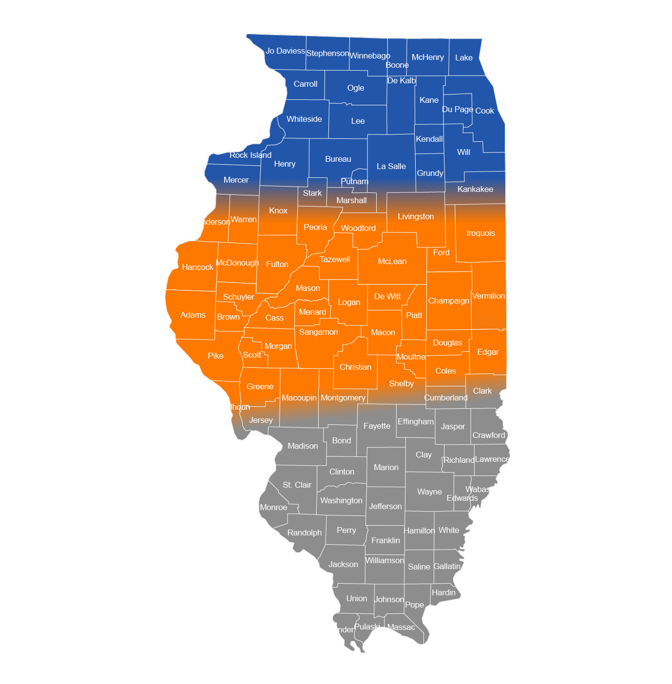
Illinois Geographic Region While we know that soils don’t change abruptly when crossing from one region to another in Illinois, N responses are different enough between northern and southern regions, and we have enough N response data to justify dividing the state as shown on the map. Northern and central Illinois join in the general vicinity of Interstate 80, and central and southern Illinois join along and north of Interstate 70, to include in the southern Illinois region those soils with lower organic matter. When in doubt in the border areas between the color coded delineated regions, assign soils with higher organic matter to the northern of the two areas and lower-OM soils to the southern area.
-
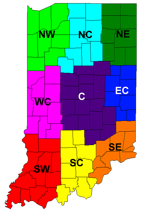
Indiana Geographic and Soil Region Research trial sites for medium- and fine-textured soils in Indiana are accumulated according to USDA-NASS Indiana Crop Reporting Districts. For sub-state specific N rate guidelines, the crop reporting districts are grouped as follows: C (central); NE/EC (northeast and east central); and all other regions plus non-irrigated sandy soils in any region. These recommendations are applicable to N management programs that use efficient methods and timings of N fertilizer application. At five Purdue Ag. Centers where paired trials of corn following soybean (corn/soybean) and corn following corn (corn/corn) were conducted, the average optimum N rate for corn/corn was 44 pounds per acre greater than for corn/soybean. More details about N guidelines for Indiana can be found at: https://www.agry.purdue.edu/ext/corn/news/timeless/NitrogenMgmt.pdf.
Note: codes in database for the three regions (beginning in 2022)
- C (Central)
- NE/EC (Northeast and east central)
- NC/NW/WC/SW/SC/SE/sandNI (North central, northwest, west central, southwest, south central, southeast, non-irrigated sand anywhere in IN)
-
Wisconsin Soil Yield Potential – Soil yield potential groups are designated for medium- and fine-textured soils and are based on soil properties such as drainage, depth of root zone, water holding capacity, and length of growing season. A list of soil series and the assigned yield potential category are provided in UWEX publication A2809 Nutrient application guidelines for field, vegetable, and fruit crops in Wisconsin. Coarse-textured soils (sands and loamy sands) are considered sands for the purposes of obtaining an N rate. Corn grown on sandy soils responds differently to applied N depending upon whether or not the field is irrigated. Thus, irrigated sands have been separated from non-irrigated sands.